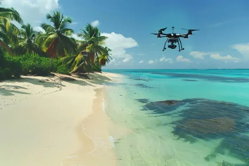
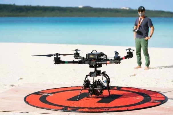
There's a moment that happens when you lift a drone above the Kerama Islands for the first time. The beach disappears beneath you, the reef unfolds in every shade of blue and green you've ever wanted to photograph, and you realize that no postcard, no Instagram reel, nothing has actually captured what this place looks like from the air. It's a feeling that's hard to shake.
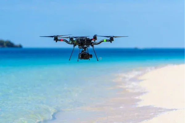
Okinawa is one of the most photogenic places in the world for aerial photography. Turquoise lagoons, ancient limestone capes, jungle rivers, uninhabited sandbars, bone-white beaches strung between emerald water and subtropical forest. From above, it looks like something out of a dream.
But flying here as a tourist is genuinely complicated. Japan has some of the most detailed drone regulations in Asia, Okinawa adds its own layer of military-base no-fly zones unlike anywhere else in the country, and the sheer number of national parks, UNESCO World Heritage sites, and protected wildlife areas means that getting airborne legally requires real preparation.
This guide is written for serious photographers and curious travelers alike, whether you're just starting to discover what aerial video can do or you've been flying drones in Japan before. We'll walk through exactly what the law requires, where you can and cannot fly in Okinawa, which locations will give you the most cinematic results, and how to approach this place with the respect it deserves.
Quick Answers: Flying Drones in Japan and Okinawa
Can tourists fly drones in Okinawa, Japan? Yes, but not without preparation. You must register your drone (≥100 g) with Japan's MLIT before flying, obtain a flight permission for most interesting locations, and navigate Okinawa-specific restrictions including military base no-fly zones and national park rules. The process is legal and manageable, it just takes time.
Do I need a license to fly a drone in Japan as a tourist? There is no pilot license requirement for low-risk Category I flights. However, virtually every worthwhile shooting location in Okinawa triggers a permit requirement (densely inhabited districts, proximity to people or structures, national parks, or military facilities). So while there is no formal license, you almost certainly need an MLIT flight permission approval.
What is the penalty for flying a drone illegally in Japan? Up to ¥500,000 in fines and one year of imprisonment under the Civil Aeronautics Act. Flying under the influence carries up to ¥300,000. Equipment can be seized as evidence.
When is the best time to fly your drone in Okinawa? Late October through early May, avoiding the May–June rainy season (tsuyu) and the July–October typhoon window.
Japan's Drone Laws, Explained Simply
Japan's drone regulations are serious, systematic, and actively enforced. Three separate pieces of legislation govern what you can do with a drone here, and understanding how they interact is the first step to flying legally.
The Core Framework
The Civil Aeronautics Act (CAA) is the main law, administered by Japan's Ministry of Land, Infrastructure, Transport and Tourism (MLIT). It covers registration, airspace, operational rules, and permitting. Think of it as the aviation authority equivalent of the FAA for Japanese drone pilots.
The Drone Act officially the Act on Prohibiting Flight of Small Unmanned Aircraft Around Important Facilities, creates hard no-fly zones around sensitive sites including military bases, the Imperial Palace, embassies, nuclear facilities, and Diet buildings. This law has particular significance in Okinawa, as we'll cover in detail.
The Radio Law governs wireless transmitters. In simple terms, your drone's radio hardware needs to carry Japanese TELEC/Giteki certification to be legally operated in Japan. Most DJI drones sold in Japan have this. Grey-market imports from overseas may not. The consequences of flying an uncertified radio are usually unenforced for tourists, but the legal risk exists.
Registration and Remote ID: What You Must Do Before You Fly
Since June 20, 2022, every drone weighing 100 grams or more (including its battery) must be registered with MLIT. This applies to everyone, residents, tourists, professionals, without exception.
Registration involves:
- Creating an account on Japan's DIPS 2.0 portal
- Providing your drone's make, model, and serial number
- Submitting proof of identity (for foreign nationals, a passport copy plus proof of address)
- Paying a registration fee (¥900 online, ¥2,400 by post)
- Waiting 5–10+ business days for verification and ID issuance Once registered, your registration number must be displayed on the drone's airframe (minimum 3 mm font), and your drone must broadcast Remote ID, a continuous Bluetooth/Wi-Fi signal identifying the aircraft, its location, altitude, speed, and operator registration. Most current DJI models support this via firmware. Older models may need an external Remote ID module.
Important for tourists: Registering your drone in another country (FAA, EASA, or anywhere else) does not count. You must register again under Japanese law to fly in Japan. Build in at least 2 weeks before your trip.
Airspace Rules: Where You Need a Permission
Three airspace categories require MLIT permission before you fly:
Airspace Type Description Near airports Complex approach-surface restrictions; Naha Airport is on the list of major airports with extra-wide buffers Above 150 m AGL Hard altitude ceiling without special approval Over DIDs Densely Inhabited Districts, covered by Japan's census data; much of central Okinawa qualifies
Beyond airspace, these operations also require advance MLIT approval:
- Night flight
- Beyond Visual Line of Sight (BVLOS)
- Flying within 30 m of uninvolved people, vehicles, or structures
- Flying over crowds or events
- Dropping objects
- Carrying hazardous materials
Universal Rules That Cannot Be Waived
These rules apply no matter what permit you hold:
- No flying under the influence of alcohol or drugs
- Pre-flight inspection required before every session
- Maintain anti-collision separation
- No reckless flight of any kind
The Risk Category System
Japan classifies drone operations into three categories. Tourists realistically operate in Categories I and II. Category III, which covers automated BVLOS over uninvolved third parties, requires a full pilot license, type-certified aircraft, and per-flight approval. It's essentially out of reach for visiting hobbyists, and recreational drone use typically falls in Category I or II.
Okinawa-Specific Drone Regulations You Need to Know
This is where Okinawa diverges significantly from the rest of Japan. The island hosts the highest concentration of US military installations in Asia, two UNESCO World Heritage designations, three national parks, and a web of locally sacred sites. Getting oriented before you arrive isn't optional, it's essential.
US Military Bases: The 300-Meter No-Fly Zone
Under the Drone Act, flying within approximately 300 meters of designated US Forces Japan (USFJ) and Japan Self-Defense Force (JSDF) installations is a criminal offense. On Okinawa, that list of military bases includes:
- Kadena Air Base - the largest US Air Force base in East Asia, surrounded by Chatan, Okinawa City, and Kadena
- MCAS Futenma - Ginowan, a densely populated city
- Camp Foster / Camp Smedley D. Butler - Ginowan and Chatan
- Camp Hansen - Kin
- Camp Schwab - Nago / Henoko (including the offshore new-runway construction zone)
- Camp Courtney - Uruma
- Camp Shields - Okinawa City
- White Beach Naval Facility - Uruma
- Henoko Ordnance Ammunition Depot
- Kadena Ammunition Storage Area
- Tengan Pier
- Naha Port (military-use section) Flying within 300 m of any of these requires consent from the facility administrator, applied for at least 30 calendar days in advance through the relevant Regional Defense Bureau. In practice, permission is almost never granted for personal or journalistic drone use. The Marine Corps Installations Pacific has stated on record that drone flights "should not be granted" as a general principle.
When you're using Drone Maps Japan or SORAPASS to check airspace, these zones appear clearly. Pay attention to them. The 300 m isn't measured from the main gate, it's measured from the fence line. In areas like Ginowan, that fence line is in the middle of a residential neighborhood.
Densely Inhabited Districts (DIDs): Naha and the Central Corridor
Much of southern and central Okinawa Honto is classified as a DID - meaning any drone flight over these densely populated areas requires advance MLIT permission. The DID belt runs roughly through:
- Naha city
- Tomigusuku
- Urasoe
- Ginowan
- Chatan
- Okinawa City
- Uruma Add this to the military base buffers layered across the same geography, and you realize quickly: the central third of Okinawa Honto is not the place to start flying. Plan your main island sessions in the north or along quieter coastal headlands.
National Parks
Three national parks fall within Okinawa Prefecture, each with meaningful restrictions.
Yambaru National Park covers northern Okinawa Honto's subtropical forest, the green, jungled north that most tourists never visit. It was designated a national park in 2016 and inscribed as a UNESCO World Natural Heritage site in 2021. Drone use is strongly discouraged in the park's core protected zones due to the presence of critically endangered species including the Okinawa rail (yambaru kuina, flightless and extremely sensitive to disturbance) and the Okinawa woodpecker.
Keramashoto National Park encompasses the Kerama archipelago, Tokashiki, Zamami, Aka, Geruma, and its surrounding marine areas. The sea here has whale habitat protections during humpback season (December–March) and coral reef conservation designations year-round.
Iriomote-Ishigaki National Park is the southernmost national park in Japan and covers Iriomote, Ishigaki, Taketomi, and surrounding islands. It contains Japan's only tropical rainforest and is home to the Iriomote cat, a critically endangered species with only around 100 individuals remaining. Flights near known Iriomote cat habitat zones are particularly sensitive.
In all three parks, you need Ministry of Environment notification or permission for flights inside Special Protection Zones and Class I Special Zones, in addition to any MLIT permits you hold.
UNESCO Gusuku World Heritage Sites
Okinawa contains nine components of the "Gusuku Sites and Related Properties of the Kingdom of Ryukyu," inscribed in 2000. They include:
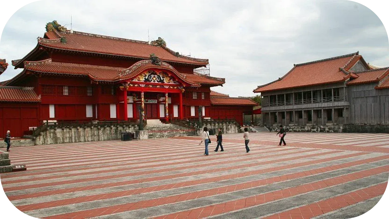
Shuri Castle is located in Naha and drone flights are prohibited. Nakijin Castle Ruins in Motobu and Sefa-Utaki in Nanjō are also fully prohibited. The same applies to Tamaudun Royal Mausoleum and Sonohyan-Utaki Stone Gate, both in the Naha/Shuri area.
Zakimi Castle Ruins (Yomitan), Katsuren Castle Ruins (Uruma), Nakagusuku Castle Ruins (Nakagusuku), and Shikinaen Royal Garden (Naha) all prohibit drone use without prior permission.
Plan to fly well outside the buffer zones of these sites. Even commercial production companies need site-specific permission, and that process runs through the Okinawa Prefectural Board of Education, not MLIT.
Protected Wildlife Areas
Two species require special care when planning Okinawa drone flights:
The Yambaru kuina (Okinawa rail) is a flightless bird protected under Japan's Cultural Properties Law as a National Natural Monument. It's also on the Endangered Species list. This bird sleeps in trees and forages near water, two behaviors easily disturbed by drone noise. If you see a sign indicating kuina habitat, stay high and move on.
The Iriomote cat (Prionailurus bengalensis iriomotensis) exists nowhere else on Earth. Roughly 100–110 individuals survive on Iriomote. The island's interior is core habitat. If you're doing low-altitude jungle flying on Iriomote, you're in the wrong place, both ethically and potentially legally.
Beach and Coastal Restrictions
Many municipal beaches post local drone bans during swimming season (roughly late March through October). Check signage at the parking lot before you unpack anything. Beaches adjacent to US base communities, Sunabe Seawall, Araha Beach in Chatan, sit inside both the Kadena buffer zone and the DID, meaning you'd need overlapping permits that effectively make these no-go zones.
The Best Drone Photography Locations in Okinawa
Here's the practical payoff. These are locations that combine legal accessibility, extraordinary visual potential, and manageable logistics. Every location below still requires drone registration and advance MLIT approval for proximity or DID scenarios, the difference is these places aren't wrapped in military-base no-fly zones or national park prohibitions that make approval impossible.
Okinawa Honto (Main Island)
Cape Hedo (辺戸岬) The northernmost tip of Okinawa Honto is one of the most legally accessible and dramatically beautiful locations on the main island. Ancient limestone karst formations rise from a convergence of the East China Sea and the Pacific, two different bodies of water meeting in open ocean. On clear days, you can see Yoron Island 23 km north. The drive from Naha takes roughly 2.5 hours but delivers you to a world completely unlike the resort towns of central Okinawa.
Cape Zanpa (残波岬) Yomitan's rugged white-limestone cliffs and the Cape Zanpa Lighthouse make this one of the finest sunset locations on the main island. The cape faces west, which means long golden-hour windows and dramatic cliff-edge silhouettes. Nearby Zakimi Castle Ruins are UNESCO-listed, keep your drone outside those inscribed buffer zones.
Cape Maeda (真栄田岬) Home to the famous Blue Cave sea cave, Cape Maeda offers a combination of cliffs, turquoise coves, and boat traffic that makes for richly layered aerial compositions. Watch the boat lanes, water taxis and dive boats run here throughout the day.
Cape Manzamo The elephant-trunk rock arch here is one of Okinawa's most recognized natural formations at ground level. Aerial photography gives you something almost no tourist photo library has: the arch in context, surrounded by open water, with the cliff line stretching away. The car park crowds at ground level vanish when you're 80 m up.
Cape Chinen (知念岬) A quiet headland in Nanjō that overlooks Komaka and Kudaka islands. Excellent sunrise spot, the cape faces east. Kudaka Island is spiritually significant ("Island of the Gods"), so fly toward Chinen itself and the open water, not over Kudaka.
Kouri Island and Kouri Bridge The 1,960-meter Kouri Bridge is one of the most photographed drone subjects in Okinawa, for good reason. The bridge cuts across shallow, blindingly turquoise water. The Heart Rock formation on the north shore of the island and the Kouri Ocean Tower offer additional subjects. Important note: do not hover over or around vehicles on the bridge itself.
Sesoko Island Connected to Motobu by the 762-meter Sesoko Bridge, Sesoko's reef shelf is one of the clearest near Okinawa Honto. The Hilton Okinawa Sesoko Resort sits on the island, so coordinate with the hotel if you're thinking of launching from nearby grounds. Fly in the early morning before beach-goers arrive.
Ie Island The volcanic plug of Mt. Gusukuyama, locally called "Tacchu," rising 172 m abruptly from flat farmland and the sea, is unlike anything else in Okinawa. Take the 30-minute ferry from Motobu Port. Important: Ie Jima has a US military auxiliary airfield. Do not fly toward or near that airfield under any circumstances.
Daisekirinzan Park Adjacent to Cape Hedo, Daisekirinzan's tower-karst rock formations look genuinely prehistoric, mossy limestone pillars rising from subtropical forest. Check with the park office before launching; access is paid and they're aware of the photography interest.
The Outer Islands
Kerama Islands (Keramashoto National Park)
The Kerama group is the undisputed pinnacle of Okinawa drone photography. Inside Keramashoto National Park, every flight requires additional care, but the results are extraordinary.
- Aharen Beach (Tokashiki): the main showpiece beach of Tokashiki Island; a white crescent between limestone headlands.
- Furuzamami Beach (Zamami): ranked consistently among Japan's best beaches. The water color here is what's known as "Kerama Blue", a specific transparency and shade that photographers specifically travel for.
- Nishibama Beach (Aka): arguably the most pristine of all Kerama beaches, with a healthy coral reef directly offshore visible in aerial shots. The island is small and the beach quiet.
- Ama Beach (Zamami): where sea turtles are reliably encountered near the reef. Ferry access from Naha's Tomari Port: 50 minutes to Zamami (high-speed), around 70 minutes to Tokashiki. Plan your stays overnight to get morning light before the day-trippers arrive.
Miyako Island Group
- Yonaha Maehama Beach: 7 km of white sand on Miyako's southwest coast, regularly ranked Japan's #1 beach. Faces Kurima Island across the shallow strait. Be aware that Miyako Airport's approach corridor passes nearby, cross-check the GSI airspace map before launching.
- Sunayama Beach: a natural sandstone arch over a pocket beach; possibly the most dramatic single natural structure on Miyako for drone photography.
- Higashi-Hennazaki Cape: a narrow 2 km peninsula tipped with a lighthouse, flanked by open ocean on both sides. The long, thin geometry of the cape reads beautifully from altitude.
- Irabu Bridge: Japan's longest toll-free bridge at 3.54 km, connecting Miyako to Irabu Island; striking structural geometry over flat shallow water. Ishigaki Island
- Kabira Bay: a Michelin Green Guide three-star destination and Ishigaki's most famous subject. The bay is protected (no swimming allowed), with black-pearl culture beds floating on glass-clear water. Drone photography here is legal with advance permission and landowner consent; local tour operators often include drone shots as part of guided SUP tours, which is the most practical route.
- Tamatorizaki Observation Point: coastal viewpoint above the eastern coastline.
- Nosokodake: 282 m peak offering a 360° panorama over the island and surrounding sea. Iriomote Island
Iriomote requires the most preparation of any island, it's largely inside Iriomote-Ishigaki National Park, with meaningful wildlife sensitivities. But the photographic subjects here are extraordinary.
- Pinaisara Falls : 55 m, the tallest waterfall in Okinawa Prefecture. Accessible by kayak through mangrove channels; the aerial view of the falls dropping into dense jungle is unlike anything else in Japan.
- Nakama River Mangrove Forest : Japan's largest mangrove ecosystem; the dendritic top-down pattern of river channels through the forest canopy is one of the most otherworldly natural textures available to aerial photography in Japan.
- Barasu Island : a micro-island made entirely of coral rubble between Iriomote and Hatoma, accessible only by boat. The island changes shape with tidal cycles. Pure white against deep blue.
- Hoshizuna-no-Hama ("Star Sand Beach") : named for its star-shaped foraminifera shells mixed into the sand. Coordinate all Iriomote drone sessions with the park ranger station in Ohara or Uehara. A local guide who knows Iriomote cat habitat zones is worth the investment.
Kume Island
Hateno-hama, a 7 km uninhabited sandbar stretching east of Kume Island, is arguably the most photographically spectacular sandbar in Japan. At extreme low tide it narrows to a thin ribbon of white floating in deep blue. Access by boat tour from Kume. Also worth shooting: Eef Beach on the island's south coast.
Yonaguni Island
Japan's westernmost island, 111 km from Taiwan, offers a completely different aesthetic — windswept, austere, dramatic. It's where the subtropical green of the Kerama or Ishigaki gives way to something more raw.
- Cape Irizaki : the westernmost point of Japan, where the last sunset of the country happens every evening.
- Agarizaki Cape : easternmost point; lighthouse on a cliff above grazing Yonaguni horses. These hardy semi-wild horses are a unique photographic subject.
- Tachigami-iwa (Sea-Stack Monolith) : a 30-meter sea stack just offshore.
- Sanninudai (Battleship Rock / Gunkan-iwa) : a 30-meter elevated rock outcrop named for its resemblance to a battleship hull.
- Tindabana Cliff — 85 m overlook above Sonai village.
- Yonaguni Underwater Monument vicinity : the controversial submerged sandstone formation lies at 25 m depth, beyond aerial camera range, but the dramatic Arakawabana sea-cliff above it and the surrounding formations are spectacular from the air.
Cinematic Shot Recommendations by Location
Capturing Kerama Blue: The Tropical Reef Aesthetic
The visual challenge in Okinawa's shallow reef areas is glare management. Without a CPL filter, you get harsh surface reflection that bleaches the water's color and hides the reef structure beneath. With one, you cut through to the seabed, coral heads, sand patches, turtle shadows, in a way that still photography with a phone simply cannot replicate. The difference is especially noticeable when you're reviewing drone video footage in post.
How to use a CPL in Okinawa's conditions: A circular polarizer works best when the sun is at roughly 90° to your camera direction. In practice: fly with the sun behind you for the most dramatic water penetration. For pure top-down "nadir" shots (straight down), the polarizer becomes directionally neutral, but you'll still gain saturation and contrast. Recommended filter combinations for Okinawa conditions: ND/PL 16 for overcast or shoulder-season light, ND/PL 32 or 64 for full summer sun. PolarPro, Freewell, and PGYTech all make model-specific options.
For deep-water "Kerama Blue" compositions, where you want the surface reflection of clouds for atmosphere, sometimes skip the polarizer entirely. The reflection adds drama.
The 180° shutter rule applies in Okinawa's brightness: Set your shutter to double your frame rate (1/60s at 30fps, 1/50s at 25fps). Okinawa's midday light will blow your exposure without an ND, you'll need at minimum an ND16 and often ND64 on bright days.
Jungle and Mangrove Cinematography (Iriomote)
Two main shot types define Iriomote from the air:
Top-down river delta pattern. Ascend to 80–120 m AGL above the Urauchi River mouth or Nakama River mangroves. The dendritic branching pattern of channels through the canopy looks almost alien, no landscape in Japan looks like this. Fly at the hour after sunrise when low-angle light catches the raised mangrove roots.
Low-altitude river tunnel. Flying the drone at canopy level over the river surface, the kayak-guide view, is cinematic but requires exceptional obstacle awareness. Maintain ≥30 m horizontal distance from any kayakers or tour boats below. The "pull-back reveal" shot: fly upstream toward the falls at 20–40 m AGL, then slowly ascend and pull back to reveal the whole jungle-wrapped valley. This takes planning and ideally a dedicated spotter.
Cliff Edge and Coastline Shots (Cape Hedo, Yonaguni)
Cape Hedo and Yonaguni's cliff structures call for two complementary techniques:
Orbital shot at 60–80 m radius around a cliff stack or headland. Keep the subject centered while the camera orbits. the changing light angle and context shift with each degree of orbit. ND filters essential at midday to keep shutter controlled.
Low-altitude push-in over the cliff line. Approach the cliff edge from the sea side, flying low (20–40 m above water), then slow the forward motion as the cliff edge comes into frame. Let the cliff fill the screen before ascending. This approach is cinematic, dramatic, and shows the sheer scale of Okinawa's limestone geology in a way nothing else does.
Sunset and Sunrise: Timing the Golden Hour by Location
Time of Day Best Locations Sunrise (east-facing) Cape Chinen (Nanjō), Higashi-Hennazaki (Miyako), Agarizaki (Yonaguni) Sunset (west-facing) Cape Zanpa (Yomitan), Yonaha Maehama (Miyako), Cape Irizaki (Yonaguni), Furuzamami Beach (Zamami)
Target the window when the sun is 5–10° above the horizon for warm light without direct lens flare. At that angle, white sand turns gold, shallow water turns amber, and shadow detail in limestone cliffs becomes visible. Plan flights to be airborne 20 minutes before the ideal angle, the approach and framing take longer than you think.
Military History Sites - A Respectful Approach
The Battle of Okinawa killed approximately one quarter of the island's civilian population. These are not exotic backdrops — they are places of deep grief for many Okinawan families. That said, aerial photography can convey the scale and context of these landscapes in a way ground photography cannot.
Where you can thoughtfully fly:
- Okinawa Prefectural Peace Memorial Park (Itoman) : the Cornerstone of Peace monument, sweeping coastline along the south, and the cliff-line from which many civilians jumped. Slow, reverent aerial movement.
- Former Japanese Navy Underground Headquarters (Tomigusuku) : exterior only.
- Maeda Escarpment / Hacksaw Ridge (Urasoe) : the landscape where one of the battle's most famous chapters played out. From the air, the ridge reads clearly against the surrounding city. Where you must not fly: The US bases themselves and their buffer zones. Not for photography, not for journalism, not for artistic purposes. The Drone Act is categorical.
Shots That Tourists Rarely Capture
These don't make most drone guides. They should.
Kameko-baka tomb clusters on hillsides. The traditional Ryukyuan "turtleback" tomb, its shape modeled on a pregnant woman's body, appears across Okinawa's hillsides, often in family clusters. From altitude, a hillside covered in these stone tombs looks like a completely alien landscape. They are private family property: ask a nearby local for permission, never overfly during the Shimi festival in early April when families gather to visit their ancestors.
The fresh/salt water confluence at Iriomote's Funauki Bay. Tannin-stained river water meets the blue ocean in a sharp, visible color boundary. You can see this line from the air in a way that's invisible from the shore.
The fish-net weir patterns at low tide. Traditional "ee" weirs built along Okinawa's reef flats appear as geometric patterns in the shallow water, like land art visible only from above.
The Yambaru red-clay roads. North of Higashi village, unpaved red laterite logging roads cut through subtropical forest in long, straight lines. Against the deep green canopy, they read as pure color contrast.
Kume's Hateno-hama at extreme low tide. The sandbar narrows to a thin white ribbon floating in open blue. It looks like it shouldn't exist, a brushstroke of white across the Pacific.
Yonaguni horses at Agarizaki. The Yonaguni horse breed is one of Japan's rarest native breeds, small, sturdy animals grazing on an exposed cliff edge with ocean on three sides. From the air at 50 m and 100 m radius, this is one of the finest wildlife-landscape image compositions in Japan.
Seasonal Weather and Wind Conditions for Drone Flying
The Tsuyu: Okinawa's Rainy Season
Japan's rainy season (梅雨, tsuyu) hits Okinawa first — and earlier than most people realize. The Japan Meteorological Agency typically declares tsuyu start for Okinawa in early May, with the 2025 season opening on May 4, six days ahead of the long-term average. It ends in mid-to-late June.
Tsuyu doesn't mean continuous rain — it means a persistent frontal system that delivers alternating grey overcast, intermittent heavy showers, high humidity, and occasional tropical cumulonimbus buildups. There are flyable days within tsuyu, but planning a drone trip around this window is risky. Ceilings drop, light is flat, and those sudden afternoon towers can ground you with no warning.
Typhoon Season
Officially May through October, though the genuine peak runs August through September. Okinawa averages three to four close typhoon passes per year, and the track of the western Pacific's typhoon corridor runs directly over the island chain. Even a typhoon that doesn't make landfall on Okinawa proper will generate dangerous swells, strong coastal winds, and poor visibility for days before and after.
Practical tip: keep every flight to winds below 25 km/h. Accept that 2–4-day weather shutdowns are a normal feature of Okinawa summers. Build buffer days into your trip if you're visiting between July and October.
Best Months for Drone Flying
January brings cool, clear weather with fewer crowds, though the northeast monsoon winds mean pilots should watch for gusts.
February is one of the best months to fly, coinciding with cherry blossom season and humpback whales in the Kerama Islands.
March continues to offer excellent conditions as temperatures warm and winds calm ahead of the rainy season.
April is generally good, though Golden Week crowds late in the month are worth factoring in.
May becomes risky as tsuyu often sets in early, bringing unsettled weather.
June is difficult, with the rainy season in full swing and high humidity persisting throughout.
July sees the rains end but typhoon season begin, keeping conditions risky but not impossible.
August is the most challenging month, peak typhoons and the busiest tourist period combine to make flying difficult.
September remains risky as typhoons are still common, though weather starts to ease toward the end of the month.
October marks the return of good flying weather, though late typhoons are still possible so careful forecast-checking is essential.
November is one of the standout months of the year, with stable conditions, clear skies, and comfortable temperatures making it excellent for flying.
December closes the year similarly to January, good overall, but the returning northeast monsoon calls for wind awareness.
Wind Patterns by Season
December–March (NE Monsoon): A persistent northeast wind dominates, often gusting 25–40 km/h at exposed coastal sites. Okinawa Honto has no significant mountain spine to buffer it. On NE-monsoon days, fly at sheltered east-coast launch points or inland valleys rather than exposed headlands.
April–May: Variable transitional winds, often the calmest launch windows of the year before tsuyu establishes.
June–September: Lighter southwest to southerly winds dominate, but sudden squalls develop without warning. The risk isn't constant wind, it's unpredictable gusts.
October–November: Increasingly northerly winds return but are generally lighter than the full winter monsoon. The clearest air of the year.
Humidity and Equipment Care
Okinawa runs at 65–85% relative humidity year-round, with salt aerosol at coastal sites. This is hard on drone hardware. After every coastal flight:
- Wipe motor arms, gimbal and body exterior with a damp freshwater microfiber
- Store with silica desiccant in a hard-shell case (Pelican-style)
- Never fly through visible mist
- Allow the drone to equilibrate 10 minutes when moving from an air-conditioned vehicle to outdoor humidity — condensation forms inside cold electronics exposed to warm, humid air
Bringing Your Drone to Japan: Practical Travel Logistics
Customs
Personal drones in carry-on luggage don't require special Customs declaration at Naha or other Japanese airports. Declare your drone as "personal photographic equipment" if asked. The main things customs actually cares about are batteries.
Battery Regulations on Japan Airlines
ANA, JAL, and all Japan's scheduled carriers follow the same IATA/ICAO-aligned rules:
Batteries at or below 100 Wh are permitted in carry-on luggage but not in checked bags — this covers most consumer drones, including the DJI Mavic 3 (77 Wh) and Air 3 (55 Wh).
Batteries between 100 and 160 Wh are also carry-on only, with a maximum of two per passenger, and airline approval is recommended. This range applies to some larger drone batteries.
Batteries exceeding 160 Wh are not permitted on passenger aircraft in either carry-on or checked luggage.
Every spare battery must be individually insulated, terminals taped or battery in its original retail bag. This applies to power banks as well. As of 2025, a separate rule also prevents power banks from being charged via in-seat USB outlets during flight.
Practical tips:
- Remove batteries from the drone body and store them separately for the flight
- Carry proof of Wh rating (it's printed on the battery label) — if the Wh isn't labelled, calculate it: Wh = Voltage × Amp-hours
- Budget carriers (Peach, Skymark, Jetstar Japan, Solaseed Air) follow the same rules; verify with your specific carrier before travel
The Radio Law / TELEC Issue
Your drone's wireless transmitter needs to be certified to Japanese standards (the Giteki/TELEC mark, 技適) to be legally operated. Drones purchased from official Japanese retailers already carry this mark. If your drone was bought overseas or is a grey-market import, it may not.
Enforcement against foreign tourists carrying personal drones is rare. But be aware the legal risk exists, especially at 5.7 GHz frequencies (requires amateur radio license) and 5.8 GHz (restricted outdoors without licensing).
The cleanest solution: bring a Japan-spec DJI drone, or stick to units that appear on DJI Japan's certified product list.
Apps and Airspace Tools
Before every flight, use at least two of these to cross-check:
MLIT GSI Map : maps.gsi.go.jp
The primary source for DID zones (red) and airport airspace (green). The authoritative government map from the Ministry of Land, Infrastructure, Transport and Tourism.
DIPS 2.0 Portal : Log in to view real-time NFZ data and file your flight plan.
Drone Maps Japan : iOS app
Foreign-pilot friendly, shows military base no-fly zones, DID overlays, and major airspace. Updated as of the 2020 USFJ-base additions.
SORAPASS :Paid commercial service that also processes MLIT applications
Useful for serious users who want support navigating Japanese civil aviation bureaucracy.
DJI Fly Safe: fly-safe.dji.com
Still useful as a reference map but since January 2025, DJI removed automatic flight blocking in most restricted zones. The map remains informative; it no longer substitutes for legal compliance.
Renting Drone Equipment in Okinawa
- Bic Camera and Yodobashi Camera in Tokyo and Osaka have far more stock than anything on Okinawa; buy mainland if you need gear.
- Kitamura Camera has multiple Okinawa stores and stocks consumer DJI lines.
- Drone Business Okinawa (
en.dbokinawa.com) operates commercially across Okinawa and offers training, qualifications, and production services. - Guided photography tours on Miyako, Ishigaki, and Kerama often include drone photography as part of the package, the operator holds the necessary MLIT permits, which means you don't have to.
Getting Around for Remote Locations
Cape Hedo, Yambaru, the east Yokatsu peninsula, Cape Chinen, and the southern war-memorial coast all require a rental car. Buses run but are infrequent. An International Driving Permit (1949 Geneva Convention IDP) is required for foreign-license holders. Rental counters at Naha Airport offer all major brands. On outer islands, local agencies dominate — book in advance for Golden Week, Obon, and summer weekends.
Cultural Etiquette and Ethics
Privacy and Portrait Rights
Even from altitude, Japanese law gives people the right to object to identifiable photography without consent. Frame to avoid faces, license plates, and visible home interiors. If footage shows a recognizable individual, blur it in post. This applies to street-level imagery captured incidentally by a low-flying drone as much as to conventional photography.
Sacred Sites: Utaki and Sacred Groves
Utaki are the most spiritually important places in Okinawan culture, sacred groves or rock formations where spirits are believed to descend. Many remain active prayer sites where local priestesses (kaminchu) still practice. They are not tourist attractions.
Never fly a drone over these sites:
- Sefa-Utaki (Nanjō) : the holiest site in the former Ryukyu Kingdom, now UNESCO-inscribed; still an active place of prayer for Okinawan women
- Kudaka Island : the Island of the Gods; many utaki, still-active ritual practice
- Sonohyan-Utaki :(Shuri)
- The Tomb of Amamichuu: (Hamahiga Island, Uruma)
- Roadside uganju :(small prayer places) in Yambaru villages If a kaminchu (priestess) or local elder asks you to land, land immediately, apologize sincerely, and do not argue.
Asking for Permission
Japanese property law gives landowners rights over airspace that affects their interests. In legal gray areas, the practical rule is simple: ask. A brief, polite request in Japanese goes very far.
"ドローンを少しだけ飛ばしてもよろしいでしょうか" : "May I fly a drone briefly?", said with a bow to a nearby resident, fisherman, or facility manager will often get a warm response. Even if the law doesn't strictly require it, the cultural norm in Okinawa's small communities absolutely does.
Fishermen and Coastal Communities
Okinawan coastal fishing is a working livelihood, not a backdrop. Stay 30+ meters horizontally from any working fishing boat, never hover over an active line, and move away immediately if someone on a boat waves you off. The tuna boats of northern Motobu and the traditional sabani canoes of Itoman are striking photographic subjects, but approach from a respectful distance.
Okinawan Tombs: The Kameko-Baka
Traditional Ryukyuan turtleback tombs are private family property. Approaching them without family connection is considered inappropriate; photographing a family visiting their ancestors is deeply inappropriate. The Shimi festival, a Ryukyuan ancestor-worship celebration where families gather at tombs to eat, drink, and share food with the dead, typically falls in early April. During Shimi, drone flight anywhere near a cemetery or tomb area is completely off-limits. Wait for a different day.
Historical Trauma and Cultural Sensitivity
The Battle of Okinawa is not ancient history to many residents. It ended in 1945, within living memory for some. One quarter of the civilian population died. The Ryukyu Kingdom was annexed in 1879. Okinawan language is UNESCO-classified as endangered after decades of suppression.
The US base presence continues to generate tension, accidental aircraft crashes, noise pollution, criminal incidents over the decades. Many Okinawans hold complex and painful feelings about this presence.
Practical guidance: Treat base perimeters as off-limits not just legally but photographically. Don't aestheticize military installations as "interesting." When you photograph war memorial sites, move slowly and quietly. When you're in a village, the greeting haisai (men) or haitai (women) is warmly received. Use Cine Mode or the quietest flight setting near populated areas.
How to Apply for DIPS 2.0 Flight Permission
The DIPS 2.0 system (Drone/UAS Information Platform System) handles everything from registration to flight plan filing. Here's the process in plain language, and a key tip for foreign pilots: start earlier than you think you need to.
Step 1: Register Your Drone
Start at mlit.go.jp/koku/drone/en/ : MLIT's English drone registration portal.
- Create an individual user account
- Select the foreign-individual path (if you don't have Japanese residency)
- Mail a copy of your passport plus a public-document proof of name, address, and date of birth (national ID or driver's license)
- Enter your drone's make, model, and serial number
- Enter your Remote ID device details
- Pay ¥900 (online card) or ¥2,400 (by post) After documents arrive, expect 1–5 business days for identity verification, then another 1–5 days for registration ID issuance. Total realistic timeline: 1–2 weeks minimum from when you mail your documents.
Once registered:
- Print or note your registration ID
- Display it on your drone's airframe (≥3 mm font)
- Enter it into DJI Fly's "Aircraft Information / RID Number" section
Step 2: Apply for Flight Permission/Approval
Go to ossportal.dips.mlit.go.jp and create a flight-permission account. Download the DIPS 2.0 Operating Manual (Application for Flight Permission/Approval) from the MLIT English page, as of March 2025, this is the most detailed English-language procedural guide available.
For your application, you'll need to provide:
- Your drone's registration ID and serial number
- A brief pilot resume: training background and total flight hours (Japan looks for at least 10 hours of relevant experience)
- An Operating Manual: you can adopt MLIT's published standard manual without rewriting if your flights stay within its standard scope. This is a significant shortcut for first-timers.
- A flight plan: specific location, dates, altitudes, purpose
- Safety measures For most tourist situations: apply for a specific time-and-place approval rather than a blanket nationwide permit, which is far harder to obtain and typically reserved for professional operators with an established track record.
The permit is issued electronically. Download the PDF and carry it with you on every flight.
Step 3: File Your Flight Plan Before Each Flight
Even with a valid permission, you need to log into DIPS 2.0 and submit the specific flight plan (date, time, route, altitude) before each takeoff. After landing, record the flight in your inspection/flight logbook.
Timing
Japan's statutory minimum is 10 business days before the flight. The realistic timeline, especially for foreign applicants, is 2–4 weeks, longer around Golden Week, Obon, and New Year, when government processing slows.
For the military-base 300 m buffer zones, the lead time is 30 calendar days minimum through the Regional Defense Bureau, and permission is almost never granted in practice.
English Resources for Foreign Pilots
- MLIT English UAS portal:
mlit.go.jp/en/koku/uas.html - MLIT English drone registration::
mlit.go.jp/koku/drone/en/ - DIPS 2.0 Operating Manual (March 2025 revision) : download from the MLIT portal
- Ministry of Defense Drone Act page (English):
mod.go.jp/en/presiding/law/drone.html - SORAPASS commercial service that can process MLIT applications on your behalf
- Japanese administrative scrivener services specializing in drone applications for tourists, fees typically range from ¥30,000–80,000 for a single location/day application; search "drone permit Japan gyōsei shoshi"
Frequently Asked Questions
Do I need to declare my drone at Japanese customs? No special declaration is required for a personal drone in carry-on luggage. It's treated as photographic equipment. The battery rules govern, see the airline section above.
Can I fly at a Kerama beach as a tourist without a permit?
Not legally if the beach is within a DID, within 30 m of other visitors, or inside a national park special zone, which covers most beach scenarios at peak time. Sunrise sessions with no other visitors present, launched from a legal launch point outside the DID, with advance MLIT approval, is the viable approach.
Is the DJI Mini 3 / Mini 4 Pro exempt from Japanese drone laws?
No. While the original Mavic Mini and Mini 2 (199 g / 249 g) fell under the pre-2022 100 g threshold in a complicated way, the current law applies to everything ≥100 g including battery. The DJI Mini 3 Pro and Mini 4 Pro both exceed 100 g. Both must be registered, fitted with RID, and operated under the same permission rules as larger drones.
Can I fly at Sefa-Utaki from a distance without overflying it?
Even if you're technically outside the immediate grounds, flying a drone near Sefa-Utaki in a way that disturbs worshippers or creates noise over the sacred grove is deeply inappropriate regardless of legal status. This is one of those situations where "legally possible" and "the right thing to do" point in different directions. Leave your drone in the bag here.
Are there guided drone photography tours in Okinawa?
Yes, and this is often the most practical path for foreign tourists. Operators on Ishigaki, Miyako, Kerama, and in the Motobu area offer tours where the operator holds the MLIT permits and handles logistics. Kabira Bay drone photography, for example, is commonly packaged into guided SUP tours. Search for local operators on Activity Japan (activityjapan.com) or Google "drone tour" + island name in Japanese.
What happens if I fly illegally in Japan and get caught?
Criminal penalties under the Civil Aeronautics Act: up to ¥500,000 fine and/or one year imprisonment. Police can seize your equipment. For military base violations under the Drone Act, authorities can also physically down or jam your aircraft. These are not administrative penalties, they go on a criminal record.
Where can I charge my drone batteries in Okinawa? Most accommodation (hotels, guesthouses, Airbnbs) has standard Japanese power outlets (100V, 50/60 Hz, Type A plug). DJI chargers handle 100–240V automatically. Carry a Type A plug adapter if your country uses a different format; the US/Canada plug is the same and doesn't need an adapter.
This guide reflects regulations current as of early 2026. Japan's drone law framework continues to evolve; verify specific procedural requirements at mlit.go.jp/en/koku/uas.html before your trip. This article is intended for informational purposes and does not constitute legal advice.
Evertrail Tours · May 8, 2026